Google Maps is murderously optimistic about the navigability of some roads
Published by marco on
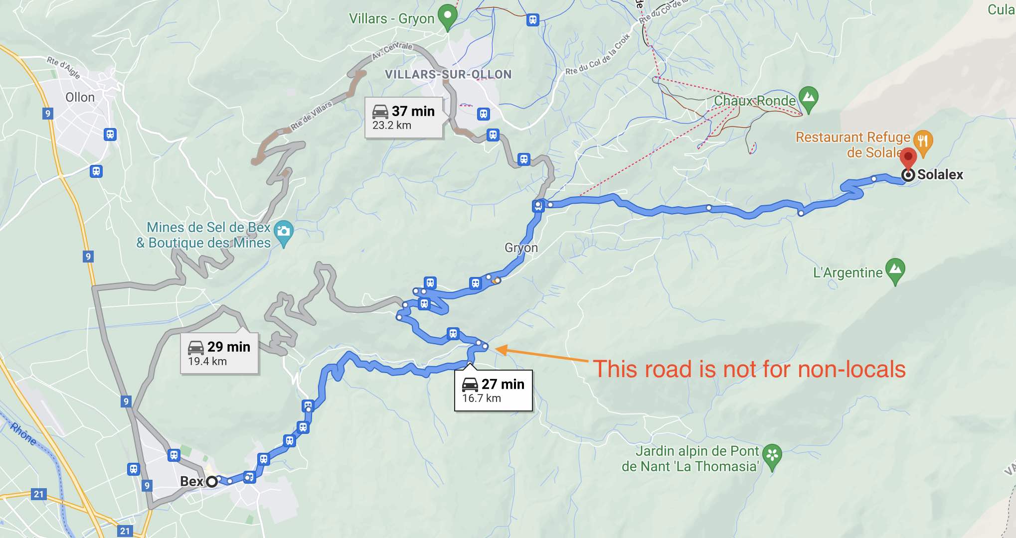
The other day, we wanted to hike L’Argentine, a challenging day-hike in the canton of Vaud in Switzerland. It starts and ends in a little “town” called Solalex. I put the “town” in quotes because it’s really just a couple of restaurants, a tiny museum, a couple of tiny shops and a few farmhouses. It’s lovely, but it wasn’t, in retrospect, surprising that the navigation system in the car didn’t know where it was.[1]
We knew a town on the way (Villars sur Ollon), but otherwise weren’t so sure of the geography to map our own way from there. So we got out a smartphone and asked Google Maps to find a route. Why Google Maps and not Apple Maps? Because my navigator has so many apps on her phone that she couldn’t find Apple Maps right away, so she used Google Maps, which she’d found first.
Google Maps showed the following routes, with the shortest route selected by default. Not knowing that much else about the roads in that region, we took the suggested route.
 Rte de la Peuffeyre on Google Maps
We drove along that route until we got to this fork in the road, with Villars clearly marked to the left (that’s the town I was nearly certain was on the way to Solalex and through which I’d ridden my bike a few years back) and Google insisting that the route lay to the right.
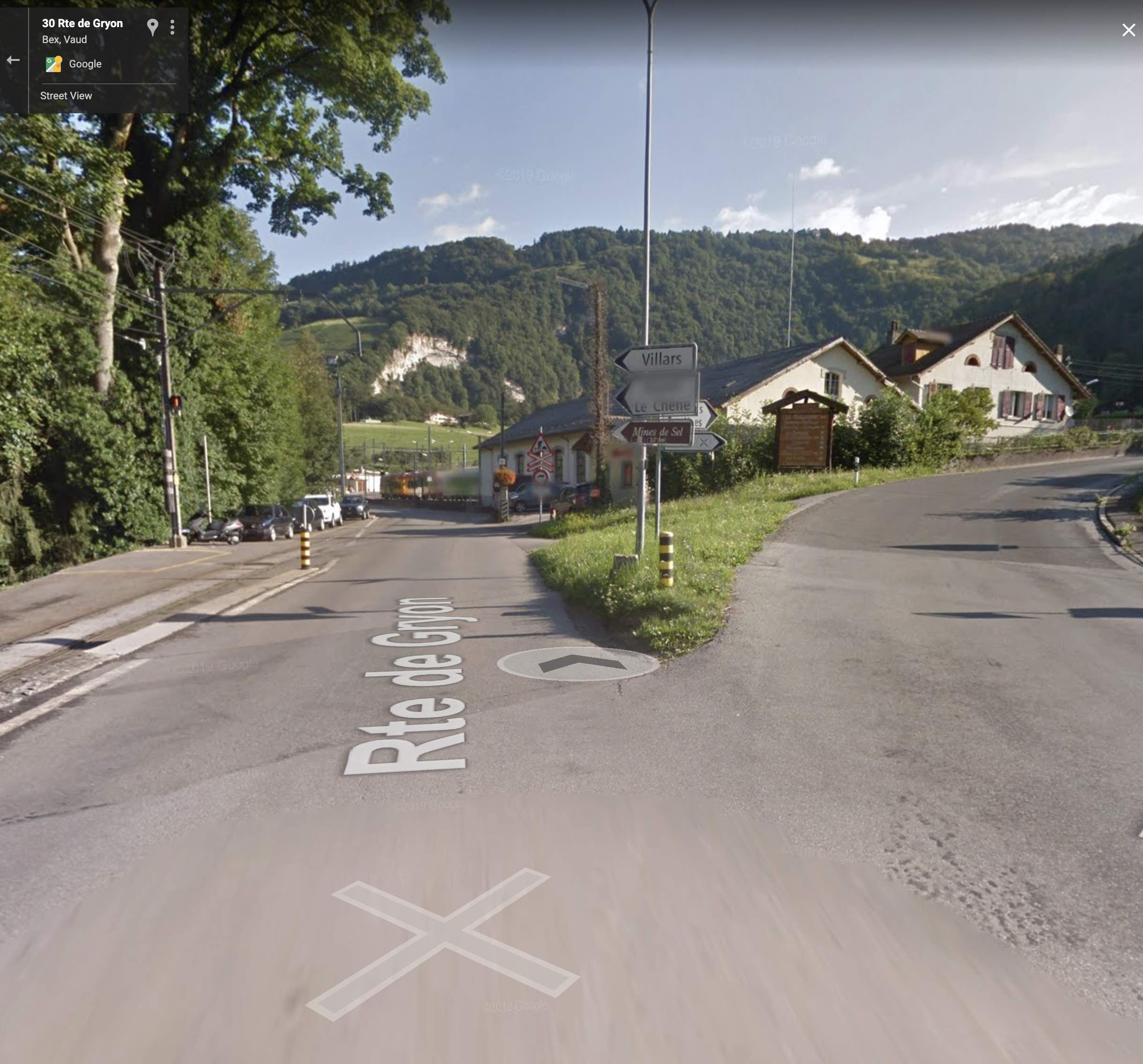 We should have stayed right toward Villars
From another angle, you can see that Les Plans is to the right and is also marked with a road sign that doesn’t indicate in any way that it would be difficult to get there with a car.
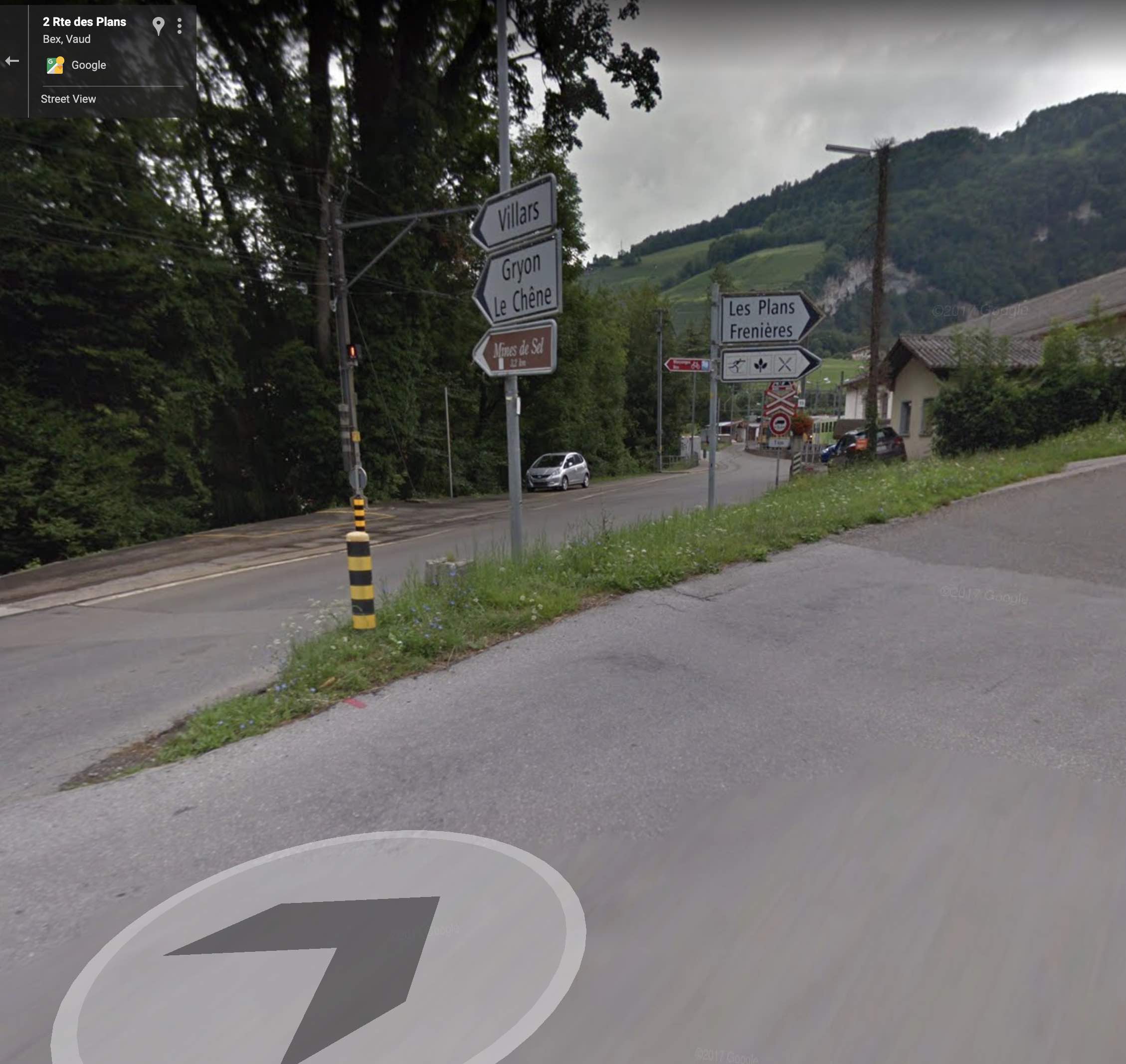 The right way and the wrong way
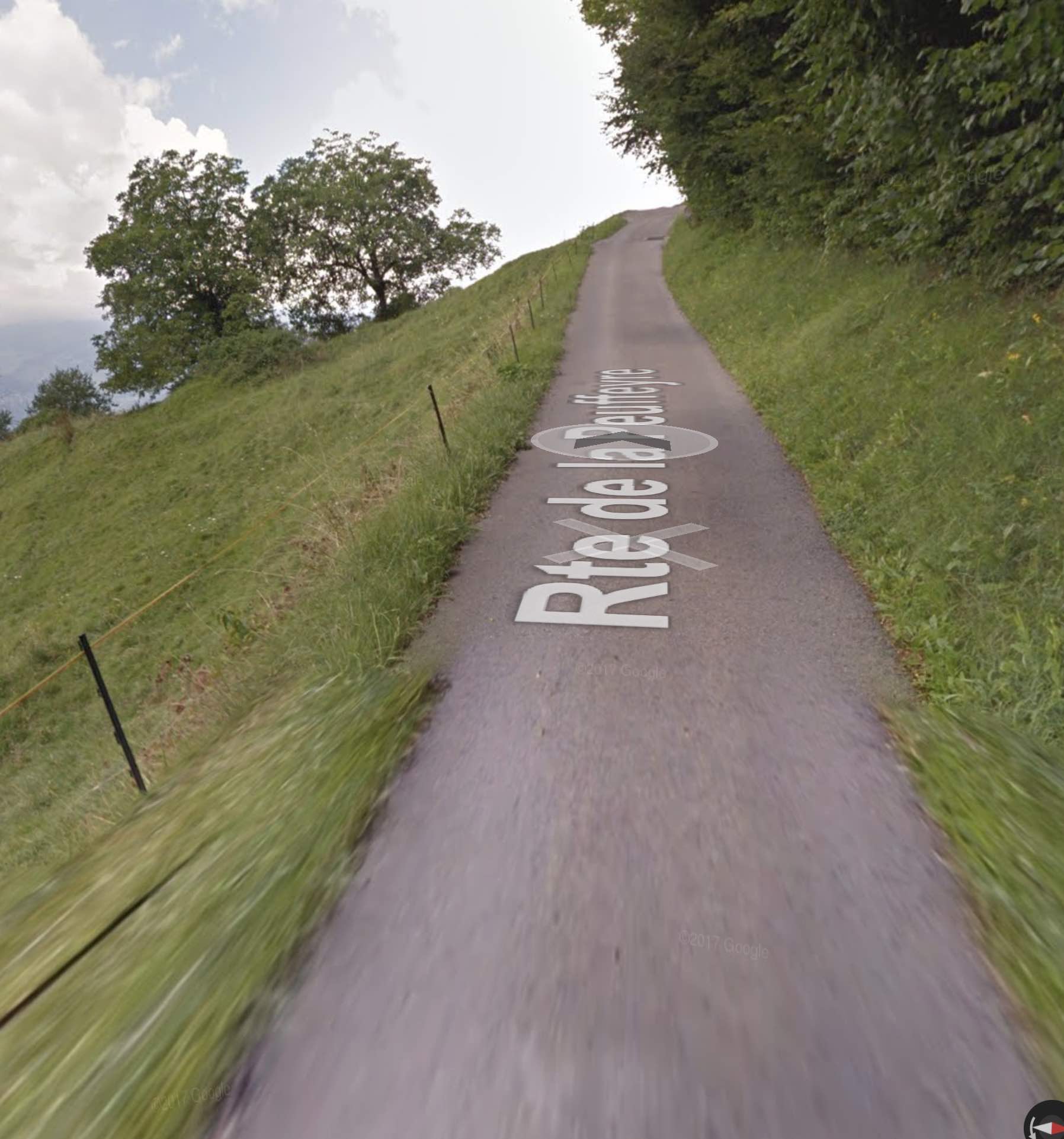
The problem is that Google wasn’t going to stay on that wide(r) road and would instead turn us onto the Route de la Peuffeyre, whose entrance looks like this.
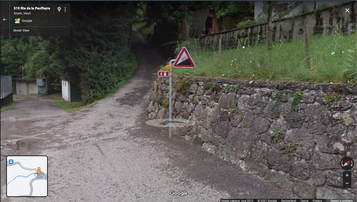 Rte de la Peuffeyre − 24% climb in Wallis
Perhaps an abundance of optimism accompanied by an unfamiliarity with navigation systems—we’d recently second-guessed ours a few times and been proven wrong—led us to think “it won’t be so bad … I’m sure it’s just the initial rise that’s 24%.” At any rate, we began climbing and the incline did, indeed, abate, but the road was still just about as wide as our car (a 2014 Golf, not a large car by any definition).
The following screenshots are from Google Maps, proving that Google drove their little mapping vehicle over this route and came to the conclusion that it was an accessible road for vehicles.
 It's pretty, but Rte de la Peuffeyre is not for motorized vehicles
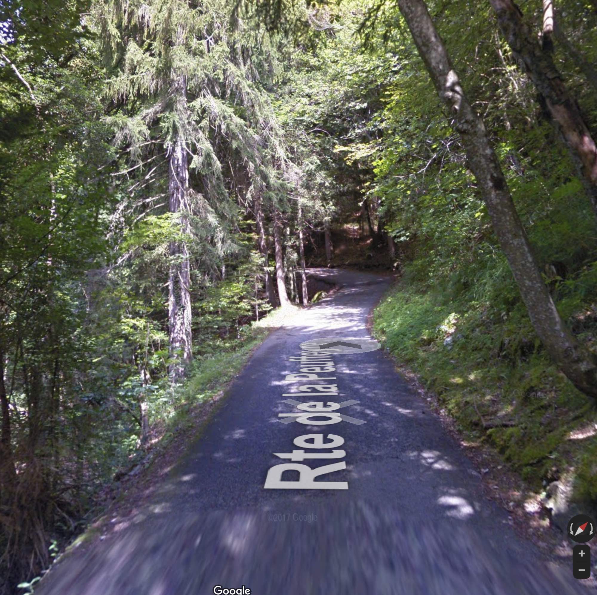
 Rte de la Peuffeyre is even hairier in the forest
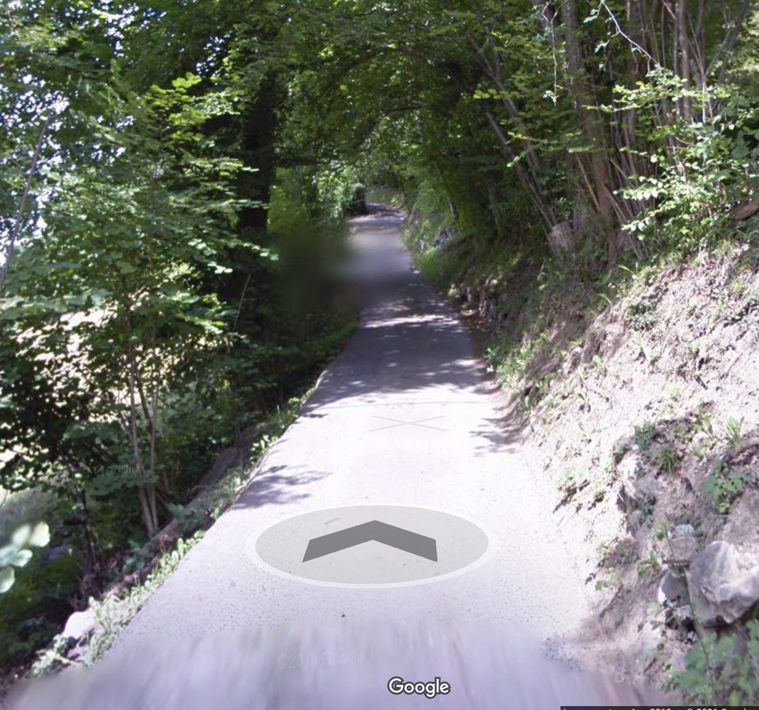
Even once you get out of the forest, the road is persistently only as wide as a car and there is almost nowhere to pull off should you encounter oncoming traffic.
 Rte de la Peuffeyre is barely as wide as a Golf
After realizing that the car (barely) fit on the road—there were a few places where the left wheel was perched quite precipitously on the edge of a road that had suffered throughout the massive storms we’d had that year—oncoming traffic eventually became our biggest concern. If this road was barely drivable moving forward and uphill, what would it be like reversing downhill along it, looking for one of the two or three (tiny) pullouts on the 1.5km stretch?
It is unconscionable that Google Maps suggests this route for cars, especially considering that Google employees have actually been on it themselves. It’s obvious that no navigation system should recommend a car drive there.
And what about Apple Maps?
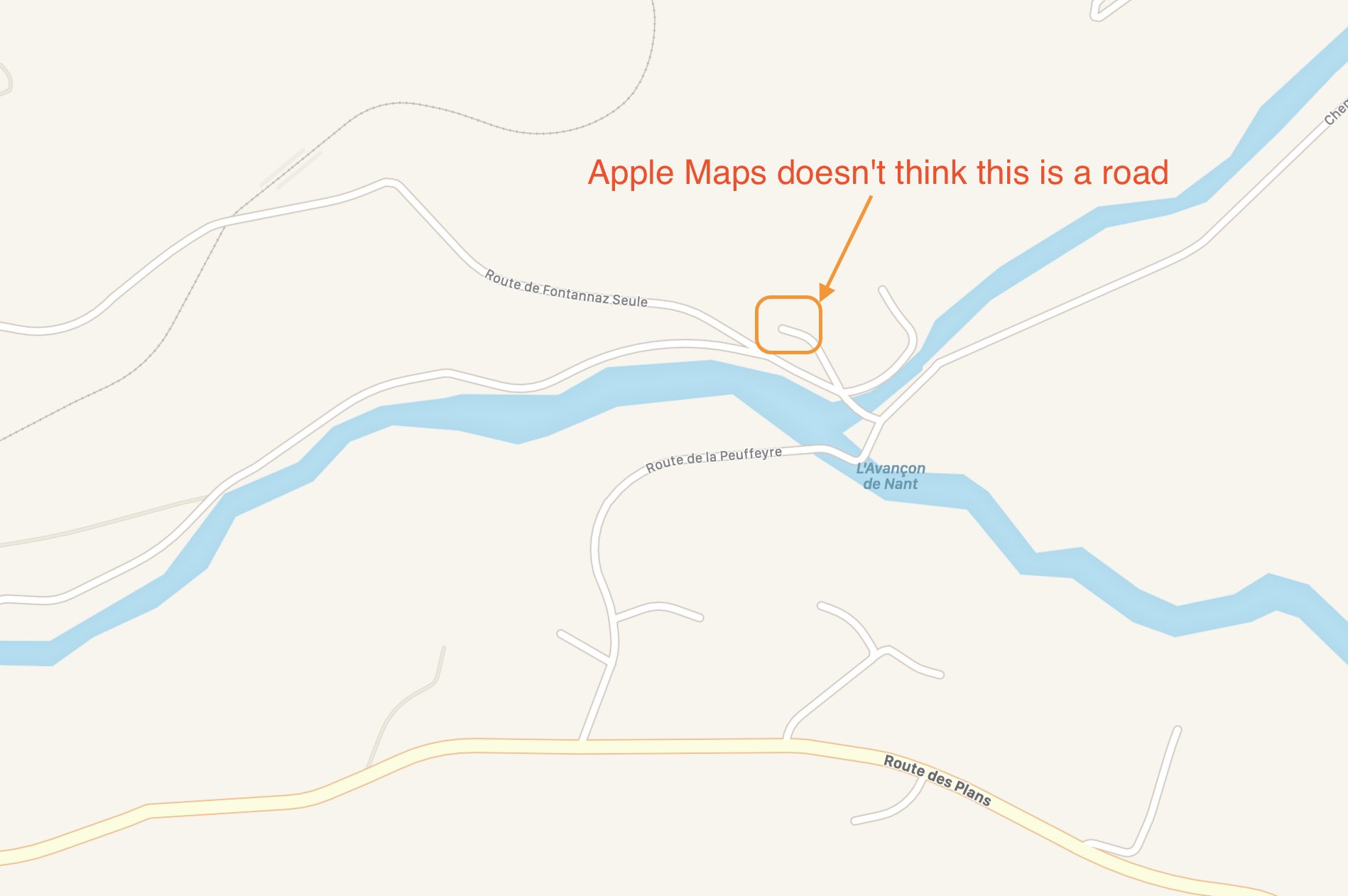 Apple Maps doesn't think Route de la Peuffeyre is navigable
Apple Maps does the right thing. It doesn’t even acknowledge that there’s a road there at all.
[1] I was a little disappointed because I’d just upgraded the navigation-system data from the 2013 version that was in there (from when we bought it used) to the most-recent December 2019 version available now. When Solalex didn’t appear, I was immediately suspicious that I’d screwed up the upgrade somehow.↩